

This article first appeared in City & Country, The Edge Malaysia Weekly on October 12, 2026 - October 18, 2026
It has been almost four months since the LRT Shah Alam line officially started operating. Some commuters have since taken to social media to voice their woes, not about the train service itself but about the lack of surrounding infrastructure.
In Malaysia, stepping off a train line does not always mean the journey is over. The station may sit only a few hundred metres from nearby developments, yet walking to one’s destination is not an easy task.
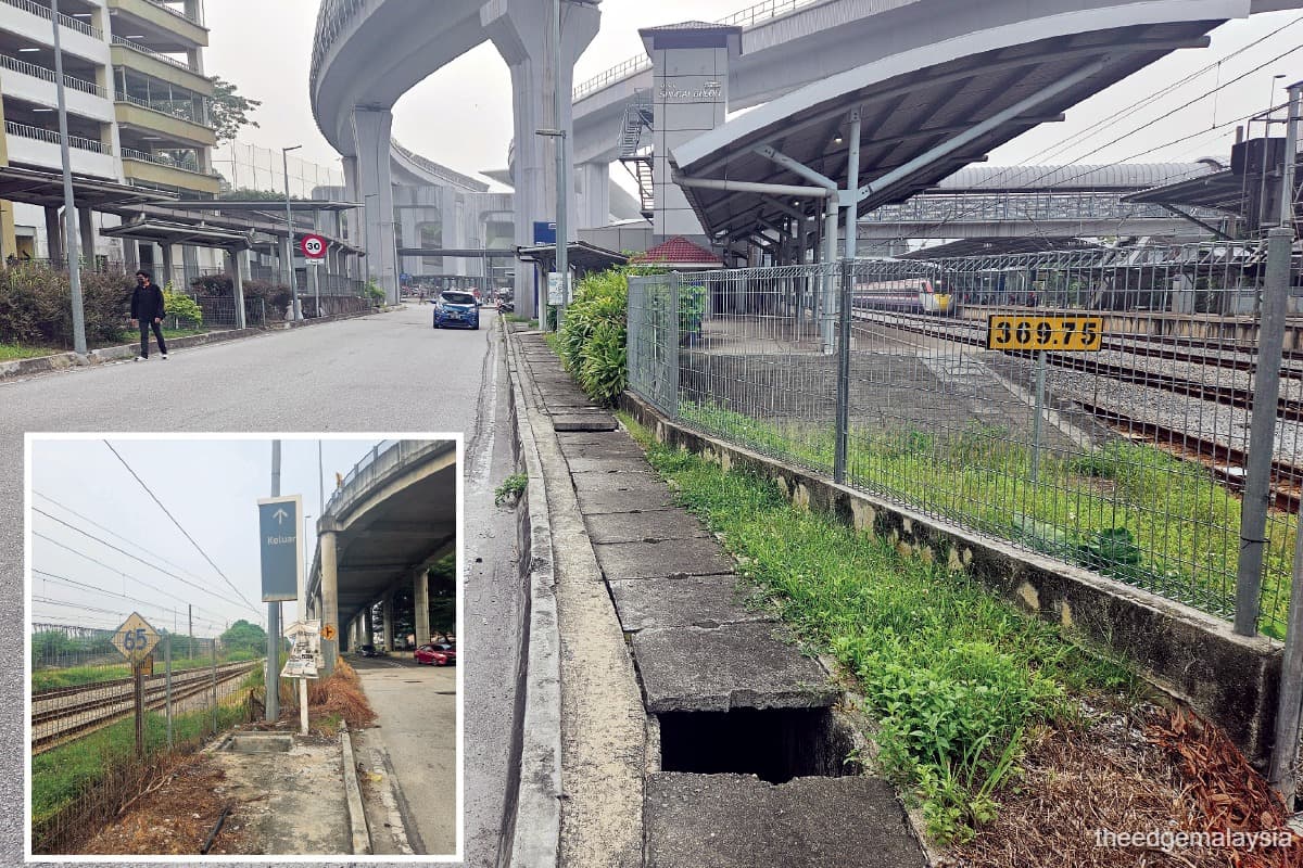
This writer took a journey on foot and encountered missing pavements mid-path, overgrown tree roots on sidewalks, uncovered drainage on pathways, roads with no pedestrian crossing and motorcycles parked on pathways, just to name a few.
On a map, many of these destinations appear close together. On the ground, however, the experience can be very different. A station might technically be within walking distance of a development, but the route may lack walkway infrastructure. In some cases, developments have been built beside the station without creating direct walkway infrastructure between the two.
To understand the reason for the country’s lack of pedestrian infrastructure, what could have been done differently and how it can be improved, City & Country speaks to town planners AJC Planning Consultants Sdn Bhd director Julie Chok and GDP Planners Sdn Bhd director Fathuddin Kamaruddin.

Unplanned planning
According to Chok, cities — particularly in the Klang Valley — introduced rail-based public transit as an afterthought. By the time rail systems expanded in recent years, much of the surrounding land had already been developed.
“Our cities were historically not planned with walking and cycling as key modes of movement. Many existing road corridors did not provide dedicated pedestrian walkways, resulting in fragmented and disconnected networks. Plot-to-plot development also tends to prioritise individual site requirements, with limited consideration for pedestrian permeability between adjoining developments,” she says.
Chok notes that in some instances, development platform levels are not coordinated at the site boundary, resulting in significant level differences that impede pedestrian movement between buildings.
“Most stations came with covered walkways and crossings to adjacent bus stops only, whereby the extension of the connection within the transit catchment is to be undertaken by the local authorities and private sector, such as owners or developers, each of whom may operate on different development and delivery timelines,” Chok elaborates.
Meanwhile, Fathuddin says back then, the country’s focus had always been on its automotive policy.
“We wanted to push forward our national cars and things like that. But over a period of time, I think in the mid-1990s, we saw the LRT and commuter rail starting to develop. But the key challenge is actually the integration of this public transport system, especially the station itself, with the surrounding land use.
“Because the infrastructure is actually planned at the federal level, it crosses multiple local authorities. To make it work, you [also] have to look at the land use planning around the stations, whereby the land use also falls within different jurisdictions and different local authorities.”
Fathuddin provides examples of some train stations in Petaling Jaya that are actually located in very low-density areas.
“There was not much that [the developer] could do at that particular time because it wanted to utilise the existing corridor. That’s why you have stations that actually run parallel to the LDP (Damansara-Puchong Expressway). Hence, you have to cross a four- or six-lane road to get to the other side.
“If we had thought about this earlier during the planning days, then perhaps in Subang, Petaling Jaya and Shah Alam, we could have had better transit-oriented developments together with more walkable city centres,” he adds.

Who is ultimately responsible?
When the LRT Shah Alam line stations opened, pedestrian access quickly became a blame game between Prasarana Malaysia Bhd and the local authorities. While Prasarana is responsible for operating the rail service and its stations, the surrounding roads, pavements and pedestrian infrastructure typically fall under the jurisdiction of local authorities.
According to a July news report, the Shah Alam City Council said pedestrian walkways were already imposed as conditions of the development order approvals granted in 2019, requiring Prasarana and the surrounding developments to provide pedestrian connections as part of the overall planning approval. So who is really responsible for what?
Both Fathuddin and Chok say it should be the shared responsibility of local city councils, the service provider and property developers.
“By right, even before the station is completed, the walkway needs to be there … The infrastructure needs to be ready from the get-go. It’s not a chicken-and-egg situation. Once you know that the station is going to be there, whether you like it or not, the pedestrian walkway needs to be in place,” Fathuddin stresses.
Typically, in any development, he says the local authority needs to develop the walkway within the road reserve.
“If there is no sufficient road reserve, then whoever owns the land, when the time comes for them to develop their land, has to surrender part of the land for infrastructure. If it’s privately owned, they have to work together with the landowner,” he explains.
At the same time, Chok says fragmented land ownership should not be a barrier to achieving a continuous pedestrian network between developments.
“Pedestrian permeability and connectivity can be achieved through a combination of at-grade walkways within public reserves, building-to-building connections, elevated linkways and, where appropriate, underpasses. This is where the local authority plays a critical stewardship role in coordinating these connections across both private and public land to ensure a seamless connection.”
For established private developments, she says the local authority can coordinate with landowners to identify and facilitate connections through their respective plots or buildings.
“Connections along and across public reserves, including road, drainage and utility reserves, would largely fall within the responsibility of the local authority to plan and deliver. For new developments, the connection can be secured as part of development approval conditions, requiring developers to deliver sections of the network.
“Remaining missing links should be delivered by the local authority and adjacent landowners to ensure a continuous pedestrian network. This ensures that the connectivity to the station is assessed as a continuous, network-wide system rather than on a plot-by-plot basis,” Chok adds.
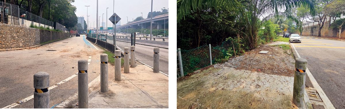
Following complaints from commuters, several local city councils began improving pedestrian access to public transport stations this year.
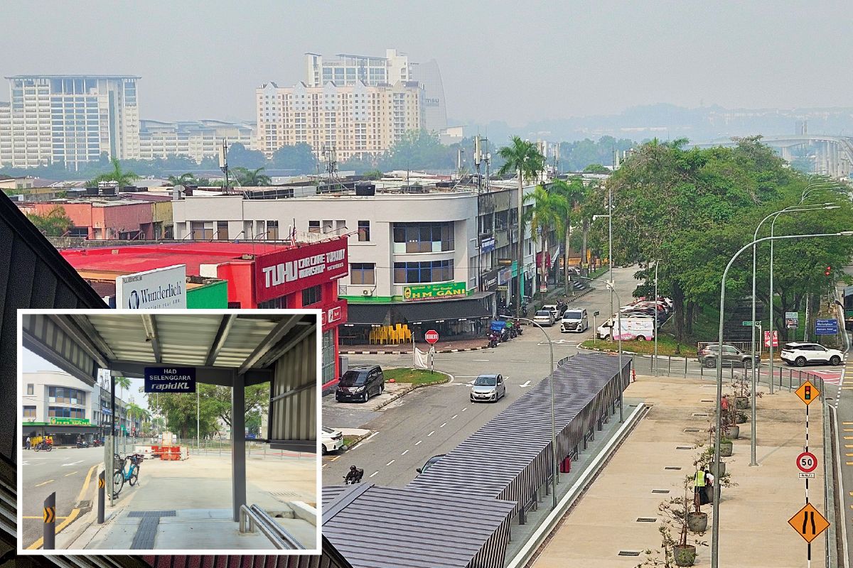
In Selangor, the Shah Alam City Council has approved the network of covered and uncovered walkways to link the Stadium Shah Alam, Dato’ Menteri, UiTM Shah Alam and Section 7 Shah Alam LRT stations to their surrounding areas.
Meanwhile, the Subang Jaya City Council started four pedestrian walkway projects in 2026, including a new walkway along Persiaran Subang Permai to improve access to the USJ 7 LRT station as well as pedestrian links between the SS15 LRT station and commercial areas, with features such as pedestrian crossings, tactile paving and wayfinding.
The Petaling Jaya City Council launched a RM1 million Safer School Streets pilot covering roads connecting SMK Taman SEA to the nearby Taman Bahagia LRT station.
In Kuala Lumpur, DBKL has upgraded a 300m walkway along Jalan Kasipillay to the Sentul Barat MRT station.
To ensure there are no blurred lines and potential blame games, Fathuddin says local city councils need to have a mechanism in place.
“You need to have not just strategic planning at the higher level, where you determine the transit corridor, but you have to bring it down to the [ground] level [to see] how this is going to be implemented. You need to have a set of very expanded guidelines.”
He says while some local city councils have statutory documents such as local plans or special area plans, some have not produced any in detail.
Chok says while the current guidelines provide a general framework for pedestrian connectivity, they may be insufficient to address the site-specific opportunities and constraints within the station catchment.
“Walkway requirements in current guidelines are typically guided by factors such as road hierarchy and right of way, rather than being calibrated to station hierarchy, expected pedestrian volumes and intensity of the surrounding development,” she highlights.
Fathuddin says local city councils can set certain requirements and parameters, but without enough details, such as local or special area plans, different developers may interpret them differently and could end up using different specifications and materials.
“Not just the developer, in fact, but various agencies that are working together in preparing all of these connections, whether it’s drainage, whether it’s Jabatan Kerja Raya or even Air Selangor, there needs to be detailed guidance for them.”
In addition, Chok suggests that the guidelines should identify and coordinate appropriate connections, including both horizontal and vertical links for multi-level connections and across private developments and public reserves, and connections to bus stops and designated multimodal hubs.
“It should also determine suitable pavement width and design, wayfinding, universal accessibility and other key infrastructure requirements for the area, followed by a strategic implementation plan that defines roles, responsibilities and actions of each stakeholder with a phasing timeline. This guideline could form part of the station precinct development guidelines that include transit-oriented development requirements for plot-level planning,” she adds.
A way forward
On how existing developments and older train stations can be retrofitted to improve walkability when there is limited land available, Chok says local city councils and developers can explore the use of air-space provisions to help overcome land constraints, including elevated or cantilevered walkways above drains, canals, stations and railway tracks, as well as building-to-building links.
“This would require a clear legal framework for air-space leases or easements involving local or city councils, land offices, transport and technical agencies,” she highlights.
Besides that, Fathuddin says local authorities can provide incentives, such as reducing statutory contributions or offering development incentives, to encourage developers to design and construct better walkways as part of their development projects.
Maintenance can also be addressed through public-private partnerships, such as Adopt-a-Park programmes, where developers work with local authorities to maintain pedestrian infrastructure.
On the key elements or characteristics that good pedestrian infrastructure should have, Fathuddin lists three main aspects.
“First, it has to be continuous and accessible, convenient to access and not cut off after a few steps, and also takes into account those who have special needs.
“Second, safety features come into play. The local authorities call this Crime Prevention Through Environmental Design. Third, it has to be comfortable. To a certain extent, you have to be covered. But there are a lot of strategies that you can implement to provide a certain extent of thermal comfort.
“A lot of people complain that it’s very hot and humid to walk in the city centre. But then again, we cannot benchmark ourselves against all of these so-called most liveable cities, because they are in a four-season country with a different climate.”
He elaborates that Singapore provides a relevant example of walkable urban design for Malaysia, particularly in addressing thermal comfort within a tropical climate.
“Taller buildings provide shade, and spaces between buildings provide a wind tunnel, so you feel the breeze coming in. There is also extensive tree planting there, so that is something that we need to look forward to implementing here in Malaysia.”
Chok says the typical arrangement for MRT and LRT stations is establishing covered walkways from the station to adjacent bus stops and park and ride facilities. She adds that some existing developments have built pedestrian bridges that are connected to the stations such as the Bandar Utama MRT station to 1Utama, One World and 1Powerhouse; Surian MRT station to IOI Mall Damansara, Sunway Nexus and Edelweiss development; as well as the Mutiara Damansara MRT station to The Curve, IPC, IKEA Damansara and Surian Tower, and onwards via the elevated walkway to The Bousteador.
Other master plans that have successfully integrated connections within the development with underground connections include Tun Razak Exchange and KLCC, she adds.
“There is no one-size-fits-all solution as each station has its own urban context, constraints and connectivity needs. A station-specific, micro-level planning approach is therefore needed to identify and address gaps in the pedestrian network within the station catchment.
“Looking ahead, planning should also aim to develop train stations with a broader mix of complementary uses and activities, maximising the environmental benefits of public transport,” Chok says.
For commuters like you and me, who have found terrible walkways, Fathuddin suggests filing complaints to local authorities or even sharing it among fellow commuters. Once it becomes widely visible, there can be an increase in awareness and action. In some cases, changes can happen almost overnight.
Save by subscribing to us for your print and/or digital copy.
P/S: The Edge is also available on Apple's App Store and Android's Google Play.