

This article first appeared in The Edge Malaysia Weekly on March 16, 2026 - March 22, 2026
When the Damansara-Puchong Expressway (LDP) and its sister highways were designed and constructed in the 1990s, their drainage systems were sized against the best rainfall data available at the time. Unfortunately, the volume of rainfall in the Klang Valley today is not comparable to what the engineers were planning for back then.
Chang Chun Kiat, director of the River Engineering and Urban Drainage Research Centre (REDAC) at Universiti Sains Malaysia’s Engineering Campus, says every highway drain in Malaysia is built to handle a storm of a specific size, measured as an average recurrence interval (ARI), which describes how often a storm of that intensity is statistically expected to occur.
A drain designed for a 50-year ARI storm should, in theory, only be truly tested once in half a century. But in an email interview with ESG, Chang warns that breaching the design threshold is not the only way the system fails.
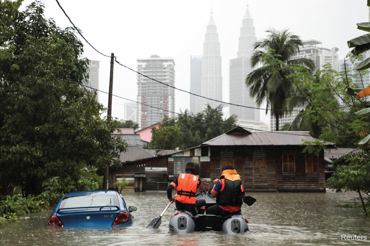
“Flooding along highways may not be caused solely by rainfall intensity exceeding the design ARI,” he says. Blocked drains, overwhelmed downstream channels and high river levels can push a system past its limits even when rainfall stays within what it was designed to handle.
Amanat Lebuhraya Rakyat Bhd (ALR), which manages the LDP, Shah Alam Expressway (Kesas), Sprint Expressway (SPRINT) and the Stormwater Management and Road Tunnel (SMART tunnel), acknowledges the pressure directly.
“We are vigilant towards the impact of higher rainfall intensities today as compared to 25 years ago,” the company says in a written response to ESG. For context, the LDP, Kesas and SPRINT were all built in the 1990s, with the SMART tunnel breaking ground in 2003.
Solid waste compounds the problem, as rubbish in drains and rivers are one of the most common triggers of urban flash floods, a problem that has little to do with how a highway was designed and everything to do with how the drainage system around it is used and maintained, explains Chang.
“Flash floods are not solely a design issue. They are often a maintenance and behavioural issue, where improper solid waste management and insufficient routine clearing compromise otherwise adequately designed infrastructure.”
According to Projek Lintasan Kota Holdings Sdn Bhd (Prolintas), which manages the Ampang-Kuala Lumpur Elevated Highway (AKLEH), Guthrie Corridor Expressway (GCE), Lebuhraya Kemuning-Shah Alam (LKSA), Sistem Lingkaran Lebuhraya Kajang (SILK), Sungai Besi-Ulu Kelang Elevated Expressway (SUKE) and the Damansara-Shah Alam Elevated Expressway (DASH), formal inspections are conducted fortnightly across its network, complemented by daily cleaning, with culverts cleared every three to six months in line with the Malaysian Highway Authority (LLM) guidelines.

Will highway runoff flood surrounding neighbourhoods?
Elevated highways like SUKE and DASH also fundamentally alter how rainwater moves through the surrounding urban landscape, Chang says. Rain falling on the deck is captured through a series of openings and pipes and discharged directly into the drains, culverts and waterways below.
This reflects what is known in engineering practice as the rapid disposal approach, where the priority is to remove water from the road surface as quickly as possible to prevent ponding and protect road safety, he says.
“Without proper attenuation measures, downstream peak discharge can significantly increase,” Chang says of elevated highway corridors. He adds that the risk compounds further down the system.
“Without adequate quantity control, even a well-designed downstream drain may experience surcharge due to the sudden concentration of flow.”
Whether elevated highway runoff worsens flooding in neighbouring low-lying areas depends on several factors, Chang says, including the capacity of the receiving drain or river, whether detention or attenuation measures are in place, and how well the highway outflow integrates with the local drainage system below it.
According to ALR, its network was designed to channel stormwater into major monsoon drains and rivers rather than into adjacent residential areas but the conditions around its highways have shifted considerably since they were built.
“The bigger challenge here is the stormwater runoff from new developments that came after the ALR highways were built … Many of these new developments have been built without proper on-site detention (OSD) systems as per the requirement of the Department of Irrigation and Drainage (JPS) … This puts additional pressure on major drainage facilities such as monsoon drains and rivers that run parallel or across the highways,” ALR says in its email response.
Integrated planning for catchment areas needed
When a highway drain meets a city drain and overflows, responsibility does not follow the water cleanly. Chang explains that within the highway reserve, drainage is the concessionaire’s responsibility. But once water crosses into a municipal drain, the responsibility falls on the local council or JPS, depending on how that drain is classified, as the two systems are physically connected but administratively separate.
“Drainage systems that are hydraulically interconnected may be administratively separated,” Chang says. He calls for integrated planning across catchments, shared data between agencies and clearer rules about who is accountable at the point where highway infrastructure meets city infrastructure.
Chang points to the Stormwater Management and Drainage Master Plan, or PISMA, as a critical tool for addressing this gap.
PISMA, formulated by JPS, is a national framework intended to guide sustainable stormwater planning across Malaysia, coordinate infrastructure improvements across agencies, and ensure that new developments align with long-term flood mitigation objectives.
According to ALR, it works closely with several local councils to manage this gap, flagging high-risk locations to Majlis Bandaraya Shah Alam, Dewan Bandaraya Kuala Lumpur and Majlis Bandaraya Petaling Jaya, among others, as well as to JPS.
ALR says it also provides residents with a 24-hour helpline to report drainage and flooding concerns linked to its network, with cases logged, tracked and escalated to the relevant agencies where necessary.
Upgrading what already exists is possible, though not straightforward, says Chang. Digging up drains on a busy operational highway requires lane closures, night works and significant disruption.
More critically, making pipes bigger without adding storage capacity, detention ponds and OSD systems risks pushing the problem downstream rather than resolving it.
“Simply enlarging pipes without storage control or downstream assessment may shift the flooding problem elsewhere rather than resolve it sustainably,” Chang says.
According to Prolintas, the company has completed several targeted projects as part of its ongoing programme, including a retention pond at the Bukit Jelutong Interchange on the GCE, a reinforced concrete culvert at Taman Bangi on SILK designed based on calculated surface runoff, and a detention pond on the SILK corridor currently in the planning stages.
According to ALR, it is installing cameras at identified flash flood locations to enable earlier warnings and faster emergency response deployment.
The SMART tunnel is frequently cited as the benchmark for highway flood management in Malaysia, a road tunnel that doubles as a stormwater diversion channel during heavy rain. Chang sees it as a genuinely significant piece of infrastructure but cautions against treating it as a blueprint applicable to every new highway.
Building an equivalent beneath a dense city is expensive, geologically complex and takes years to deliver, he says.
“Each proposal should be carefully evaluated based on catchment suitability, downstream impacts, integration with existing drainage systems and overall cost-benefit considerations.”
Save by subscribing to us for your print and/or digital copy.
P/S: The Edge is also available on Apple's App Store and Android's Google Play.