

This article first appeared in The Edge Malaysia Weekly on January 19, 2026 - January 25, 2026
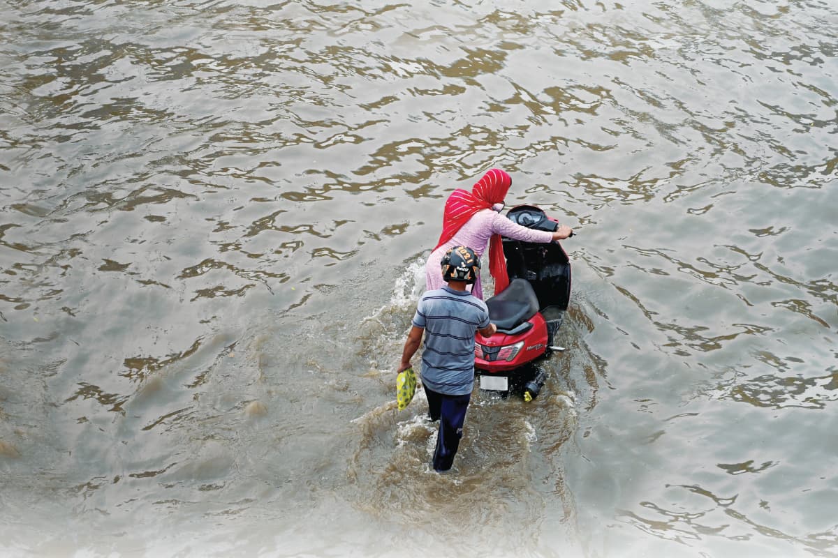
Many of Malaysia’s floods are no longer just freak events caused by extreme weather but rather, a result of the predictable consequences of how the country plans, approves and builds its infrastructure.
Engineers and hydrologists say the damage, often blamed on climate change and heavy rainfall, also points to a deeper failure — a planning system that allows land to be developed faster than flood risks can be managed, with little regard for cumulative impacts across river basins.
At the heart of the problem is a jurisdictional split, says S Piarapakaran, president of the Association of Water and Energy Research Malaysia (AWER).
He explains that land use decisions sit with state governments, which rely heavily on development approvals and land premiums for revenue. Flood mitigation, meanwhile, is handled by the federal government through agencies that have little or no enforcement authority over those same land use decisions.
“Land use is under state government. Flood mitigation is done by a federal agency that has little to no enforcement power. They cannot, for example, compel developers to absorb the additional runoff generated by their projects,” says Piarapakaran.
The Rimba Disclosure Project (now known as RimbaWatch), for instance, has documented that substantial tracts of forested land were being listed for sale online in 2023.
These tracts may be privately owned or state-owned forested areas, as not all forests fall under reserves managed by the federal Forestry Department. However, any forest clearing, even on state land, technically requires approval from the department.
The result follows a familiar pattern where developers capture profits and states collect premiums, while the costs of flooding are borne by federal budgets and downstream communities. The floods of December 2021, which left 54 dead and required the evacuation of more than 400,000 people from their homes, illustrate this cost clearly. The Department of Statistics Malaysia (DoSM) reported that Selangor bore the brunt of the economic impact, accounting for RM3.1 billion of the RM6.1 billion in national losses.
In terms of overall losses by category, losses in public assets and infrastructure totalled RM2 billion, followed by houses (RM1.6 billion), vehicles (RM1 billion), manufacturing industry (RM0.9 billion), business premises (RM500 million) and agricultural industry (RM90.6 million).
Malaysia has to prepare for more flooding
Research by Malaysia’s National Hydraulic Research Institute shows that by 2100, rainstorms could become 12% to 20% heavier. At the same time, sea levels along the west coast are expected to rise by about half a metre. These changes are expected even if the world tries to limit global warming to 1.5°C.
This means that Malaysia has to prepare for a future with more intense rainfall and flooding events.
In the 2026 Budget, the government allocated RM2.2 billion to continue 43 high-priority flood mitigation projects nationwide, including 12 new projects starting in 2026 in seven states. The National Disaster Management Agency will receive RM460 million to strengthen disaster response.
Separately, RM260 million has been allocated for slope repairs and RM55 million to upgrade drainage systems under local authorities.
These projects, however, must be done within a time frame and consider future land use changes to be effective.
Piarapakaran says flood mitigation systems are designed based on fixed assumptions about catchment areas, rainfall patterns and expected runoff, but the real weakness is not engineering design; it is timing.
“Once I know my catchment area, I design flood mitigation based on certain rainfall patterns. But by the time a project takes 10 years to complete, land use upstream may already have changed. Forests turn into housing, for example, and surface runoff increases, rendering the original design less effective or obsolete.”
Datuk Lim Chow Hock, a water engineer who spent 36 years at the Department of Irrigation and Drainage (JPS), says the scale and cost of flood control often push projects into long, fragmented timelines. “These infrastructures are very expensive. Sometimes, the nation cannot afford the complete solution, so allocation comes in piecemeal, as a flood mitigation scheme can take 10 to 15 years.”
The delay is concerning because land use rarely stays static over the same period, he says. Upstream land may be cleared, more roads are paved and drainage networks are connected into rivers that were never designed to carry such volumes of water.

The forest loss multiplier
According to a 2022 ISEAS-Yusof Ishak Institute report on the 2021 floods, deforestation is often cited as the direct cause of floods, but the report notes that disasters typically result from multiple contributing factors.
A tropical rainforest is able to intercept and trap about 30% of rainfall in its canopy. Among the rest, most of it is usually absorbed by the soil and taken up by tree roots.
When vast hillsides are cleared for agriculture, mining or development, or even when there is selective logging for timber, there is undoubtedly an impact on areas downstream, as rainfall cannot be absorbed as much as it would have been by a fully intact primary forest.
The Sultan Abu Bakar Hydroelectric Dam in Cameron Highlands is an example showing the downstream consequences of deforestation, says Piarapakaran.
Originally built in 1963 to support hydroelectric power, irrigation, drinking water supply and flood mitigation, its effectiveness depends heavily on the integrity of its upstream catchment.
“When you develop upstream, you cause siltation. The dam loses capacity and water that should be retained simply spills over.”
Siltation at the Sultan Abu Bakar Dam, also known as Lake Ringlet, had significantly reduced its effective water storage capacity, largely due to sand and silt washed in from upstream development and land use activities along the Bertam River, he says.
The reduced capacity heightened flood risks downstream, as seen on the evening of Oct 23, 2013, when the dam operator carried out three emergency water releases following heavy rainfall in the catchment.
The sudden discharge triggered a massive flood in the Bertam Valley, causing widespread destruction of property and claiming four lives.
On Nov 19, 2019, the Court of Appeal upheld a lower court’s ruling that Tenaga Nasional Bhd, the dam operator, was negligent in the manner the water was released, finding that the emergency discharge directly caused the flood and its consequences.
Both experts point to deforestation as the single biggest driver of worsening floods.
“In a natural forested hill area, surface runoff might be around 10%. Once it is cleared, runoff can increase five to eight times,’’ says Lim, who is the chairman of Malaysian Capacity Development Network for Sustainable Water Management (MyCDNet).
The Langat River Basin shows this transformation in real time. Stretching 183.65km and covering 2,663 sq km across Selangor, Negeri Sembilan, Kuala Lumpur and Putrajaya, it has been steadily converted from a forested catchment into agricultural estates, housing, factories and highways.

“Everything is blamed on climate change,” Piarapakaran says. “I don’t deny climate change plays a role. But we need to puncture this excuse because we are losing so much forest. When you lose forest, you lose the natural sponge.”
The impact extends beyond floods. Reduced forest cover also lowers base river flows during dry seasons, concentrating pollution and degrading water quality.
Wetlands, especially peat swamps along rivers, once absorbed floodwaters, but many have since been filled for development, says Lim.
“Wetlands act like sponges that hold water. When we reduce these wetlands or fill them in, we lose that natural storage space. When humans encroach on natural waterways and then experience flooding, we shouldn’t blame the rain.”
Failure to comply with regulations
In Malaysia, there are already regulations compelling developers to flood-proof their projects. For instance, under the Street, Drainage and Building Act 1974, large developments must construct retention ponds to manage excess runoff.
However, by breaking projects into smaller parcels, developers can sometimes avoid triggering requirements that apply to larger developments.
“Retention ponds and rainwater harvesting are a major solution for downstream flood control. They are already mandatory for institutional buildings, commercial developments and major residential projects such as bungalows,” says Lim.
The ISEAS report gives another example: Federal and state regulations require minimum buffer zones along riverbanks and coastal mangrove forests, yet settlements frequently emerge too close to waterways, and some developers manage to work around these requirements.
Many of these buffer areas along rivers and coasts lack official gazettement for protection, while others fall within private land boundaries. This limits the ability of the JPS and local councils to enforce regulations.
Additionally, according to the ISEAS report, some developers direct drain and stormwater overflow into shared retention ponds rather than building dedicated drainage systems to save on costs and space, which violates city and town planning guidelines and the National Land Code.
Piarapakaran recalls the development of Phileo Damansara in the 1990s, where drainage from the project was channelled into a small river running through Universiti Malaya.
“Every time it rained, my residential colleges flooded. They followed the design criteria and connected into existing drainage. But that drainage was never designed to carry that volume of water.”
In Taman Garing, Rawang, an upstream housing project triggered chronic flooding that recurred from 2003 through the 2010s in a downstream settlement reliant on septic tanks. The flooding was severe enough that wastewater would back up into homes.
“When it flooded, water came up through the toilet bowl. Residents had to build barriers at their (toilet) doors just to stop floodwater entering their homes,” says Piarapakaran.

Downstream communities suffer
These structural failures play out differently depending on geography, but the direction of harm is consistent.
A report by Gerimis Art Project and the Malaysian Humanitarian Action and Coordination Hub (kitaMATCH) documents the experiences of Orang Asli communities living along the Langat Basin during the December 2021 floods.
The report, titled “Dari hulu ke hilir: a report on indigenous knowledge for disaster risk management along the Langat River Basin”, was published last September.
At Kampung Orang Asli Paya Lebar, located upstream in the Langat River Basin, floodwaters arrived as debris flow following heavy rainfall, says Gerimis researcher and co-founder Wen Di Sia. “The upstream community had to deal with mud and debris ... (it was) like a landslide. There was wood debris because of logging in the forest upstream, left years ago.”
Villagers sheltered in a stilted community library as electricity and mobile signals were cut for two weeks. Thick mud filled homes, crops were destroyed and the community’s gravity-fed water systems were badly damaged.
Downstream in Bukit Tadom, Banting, the situation was different. As it was located on peat swamp floodplains near the coast, runoff from upstream developments met high tides from the Strait of Malacca.
“In December and January, even low tide is not very low. When heavy rain coincides with high tide, water cannot flow out.”
The result was two weeks of stagnant flooding and three years on, some homes remain unrepaired, with annual flooding now being treated as normal.
Sia also points to a supposed bias built into development patterns that exclude vulnerable communities.
“Eventually, these villages are just going to face more and more severe floods. When people do new development, they will always build higher ... so water is going to flow to the lowest parts of the land, which are usually, in these cases, Orang Asli areas.”
She stresses that Orang Asli communities are not passive victims awaiting assistance but custodians of sophisticated environmental knowledge the state currently overlooks.
Their indigenous monitoring systems track specific flood indicators, from river discoloration signalling upstream erosion to changes in fish behaviour and rain patterns that forecast danger days in advance.

The December 2021 floods showed how these forces compound. Intense rainfall coincided with king tides, preventing drainage to the sea while runoff surged downstream.
“If heavy rain comes during low tide, water can pass out. But in December, the timing is wrong,” says Sia. For low-lying developments, this creates growing financial risk, rising insurance costs and the prospect of stranded assets.
Before it is too late, Malaysia must close its regulatory loopholes by introducing catchment-wide planning that accounts for cumulative impacts, not just for individual projects, say the experts.
Retention infrastructure needs to be mandatory and enforced, says Lim. “If every household contributes, for example, a small rainwater harvester, runoff could be reduced by 20% to 30%.”
Critical catchments must be designated as no-development zones, he adds. He also points out that flood risk maps already exist, and making them public would shift risk back on to buyers and developers.
“There is no such thing as flood-free. Structural measures help, but land use control is the most important non-structural measure.”

Save by subscribing to us for your print and/or digital copy.
P/S: The Edge is also available on Apple's App Store and Android's Google Play.