

This article first appeared in The Edge Malaysia Weekly on December 29, 2025 - January 4, 2026
Selangor has positioned itself as a proponent of sustainable growth under the newly unveiled Selangor Agenda for Green Economy (SAGE), but as climate change accelerates — subjecting the state to increasingly intense heatwaves, flash floods and coastal erosion — the effectiveness of these policies and plans are being stress-tested on the ground.
To ensure that its policies, backed by science, are implemented on the ground, the state established the Selangor Climate Adaptation Centre (SCAC) this year to act as a central coordinator and reference centre for climate policy, and help local councils translate global climate science into local and implementable action.
The state also chose to decentralise its climate strategy, as climate impact varies by geography. Instead of a blanket approach, the state is set to require each of its 12 local authorities to develop a localised climate action plan.
“Local authorities [located along] coastal areas face different risks compared to those in a dense urban centre,” says Selangor’s public health and environment executive councillor Jamaliah Jamaluddin.
“SCAC will support them with data and projections — identifying flood risks or heat islands — but the local council must draft an action plan that reflects its specific economic and environmental reality. For instance, a council focused on tourism will have different ESG priorities than one focused on heavy industry.”
This localisation ensures that high-level policies like SAGE filter down to municipal planning and zoning laws. It also integrates with the soon-to-be-established “one-stop centre” for development approvals, ensuring that new projects, particularly in sensitive areas like hill slopes, undergo rigorous environmental impact assessments and social impact assessments.
The real challenge for Selangor now lies in the granular details of urban planning, specifically bringing to reality localised projects that adapt and mitigate climate risk.
Lack of baseline data
However, translating policy into action requires quality inputs, an area where Malaysian urban planning often faces structural hurdles. Urban conservation specialists with Think City, who are currently working on a nature-based solutions project for climate adaptation with the Shah Alam City Council (MBSA), highlight that the biggest bottleneck for effective planning is the lack of primary, detailed data.
“When we look at baseline studies, we need to know the vulnerability, the extent of the area affected, and the frequency and intensity of climate events,” says Rose Afrina Mansor, manager at Think City.

“For example, when an area floods, we don’t just need the sub-district population data, which is usually all that is available. We need to know the exact flooded area, the residential units affected and the population density to accurately assess the impact. This level of granular data is crucial for the accuracy and quality of the analysis.”
The group’s project with MBSA, now entering Phase 2, is designed to support Selangor’s broader sustainable plan by providing implementation-ready climate-proof solutions. This approach endorses the need for local council-specific action plans, acknowledging that climate issues vary drastically across Selangor, as some councils face coastal flooding while others deal with landslides or urban floods.
More importantly, these baseline studies are forcing a necessary paradigm shift at the local councils themselves. The process helps build internal capacity for climate change knowledge and encourages different departments, often working in silos, to work together on unified, preventive measures.
“The focus must be on preventive spending of public funds, not just post-flood spending. By using science and data up front, cities can justify investing in grey and green infrastructure that preemptively protects assets and saves much larger sums in disaster recovery costs down the line,” says Rose.
The link between urban planning and flash floods is an unavoidable topic. SCAC executive director Danial Lee acknowledges that while planning is a factor, issues like waste management, infrastructure maintenance and drainage capacity also play a role.
As a facilitator rather than a regulator, SCAC provides the technical evidence local councils need to strengthen planning approvals.
“Rainfall will be more intense and frequent as a result of climate change. And planning and development regulations need to be updated with the new information and projections,” he says.
Managing high flood risk areas like Shah Alam
Shah Alam, Selangor’s capital, presents a complex case study in urban climate resilience, facing interconnected challenges from more intense rainfall, rising urban heat and increased surface runoff caused by rapid urbanisation.
The entire programme is envisioned in up to four phases, with the long-term goal being the final project implementation. The next phase with MBSA is tentatively scheduled to commence around February.
The initial baseline study served as a starting point for building its internal capacity on climate change knowledge, calling on different departments to work together for a holistic solution.
Think City, through its baseline study, highlighted three critical spatial findings that MBSA must prioritise for long-term flood risk reduction.

The first finding points to widespread insufficient drainage volume and incomplete drainage networks in key urban areas. Many high-density areas are served by drainage systems that no longer match today’s runoff volumes, with lines sometimes incomplete or disconnected.
“The priority is to invest in systematic drainage upgrading and ensure full network continuity, guided by updated hydrological data and future climate projections,” says Kang Chuen Siang, senior manager at Think City.
Furthermore, the approach must evolve beyond mere water channelling, he stresses, as there is a need to use nature-based solutions (NbS) to enhance the drainage system’s function.
“This transforms [the drains] into temporary retention areas to store water before release. This dual function is expected to significantly reduce the occurrence of urban flash floods,” he adds.
The second critical issue focuses on low-lying neighbourhoods located in close proximity to rivers, specifically areas like Seksyen 13 and Seksyen 25. These areas face compounded risks as they are exposed not only to flash floods but also to river overflows, which drastically increase exposure during intense rainfall, says Kang.
“The required action is to strengthen river-corridor management, including NbS buffer zones, retention features and river-urban interface improvements that reduce overflow risks,” he adds.
Finally, the study identified rapid development patterns that require updated guidance for both new and existing buildings. As the city grows, new infrastructure must be designed to manage water flow and temperature at the parcel level, ensuring that new developments do not exacerbate existing climate-related problems.
Kang says the urgent priority here is to develop and mandate guidelines for integrating NbS into new developments to manage surface runoff and improve the microclimate.
A significant challenge in executing climate adaptation strategies in Malaysia is the pervasive lack of raw or detailed data, a common issue when attempting to conduct detailed analysis.
Detailed data, such as high-resolution digital elevation models, is crucial for mapping elevation and slopes to understand water flow during rainfall events. Nevertheless, the commitment shown by MBSA is a positive step, says Kang.
Improve walkability and cycling lanes in Selangor
Complementing the focus on flood resilience is a growing push for sustainable transport, directly addressing carbon emissions, of which transport is a leading source. The solution lies in promoting active mobility, which refers to the use of non-motorised options like walking and bicycles.
The organisation spearheading this transformation locally is Bike Commute, which serves as a local liaison to the Global Designing Cities Initiative (GDCI), an international organisation under Bloomberg Philanthropies. Its work, which started with a pilot project with Kuala Lumpur City Council (DBKL) on a safe school street, is premised on reimagining how streets could be.
A core component of this effort is ensuring safe, comfortable infrastructure for cyclists. The current reality is that bike lanes often carry numerous risk factors — they are susceptible to obstructions frequently placed next to high-speed roads. This results in users, especially children, feeling uncomfortable and unwilling to use them.
To address this, the organisation advocates for safer pedestrian access and protected bike lanes and networks. The key is reconfiguring streets to provide safe access for these modes of transport, rather than designing streets solely for cars, says Bike Commute director Justin Lee.
An example is a parking-protected bike lane. Unlike typical layouts, where the bike lane runs between parked cars and the curb, putting cyclists at risk of collisions with moving traffic or car doors, this design positions the parked cars between the cyclist and traffic, using them as a physical barrier for safety.
The target of these interventions is to encourage cycling for short distances. Justin says that if widely adopted across a connected network, such short-distance cycling can significantly reduce both congestion and carbon emissions.
The e-bike sharing systems can be placed strategically at busy pedestrian junctions, using docking stations similar to those used in New York, along with app-based tracking to prevent misuse and improve bike management, he adds.
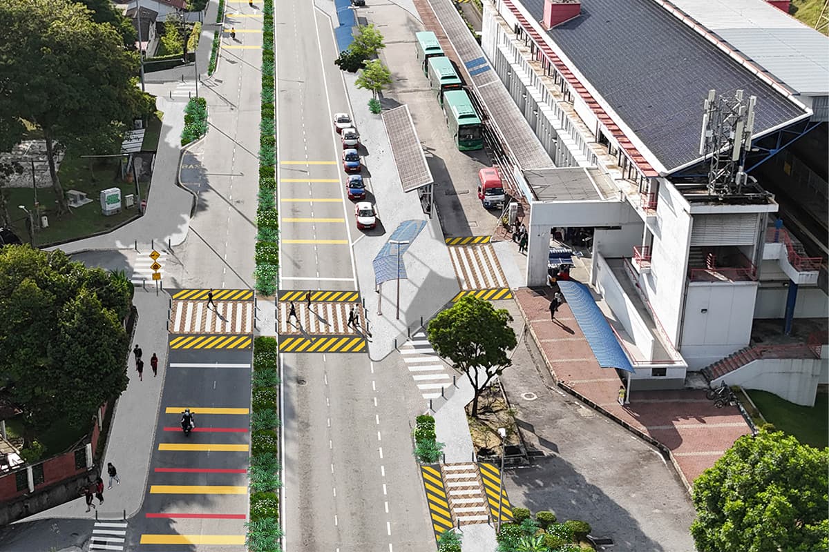
For pedestrians, the goal is also to ensure safety and comfort. The recommended infrastructural improvements to prioritise pedestrians over cars include raised pedestrian crossings, lane narrowing and curb extensions. The benefit of these features is that they force vehicles to slow down, improving accessibility for walkers.
In order to get public acceptance and understanding, Bike Commute started these projects in school zones before expanding to other areas. This is because the safety of children is of high priority, as their lives matter more than the convenience of drivers.
“Signage and paint are not infrastructure. It is easy to tell people to slow down, but real infrastructure — physical barriers and redesigned roads — is what truly educates people on how to use the space safely,” says Justin.
The organisation has completed one project at Phileo Damansara. It is in the midst of developing another project at SMK Taman Sea, which is undergoing extensive community development, and is in discussions with the Subang Jaya City Council (MBSJ).
Save by subscribing to us for your print and/or digital copy.
P/S: The Edge is also available on Apple's App Store and Android's Google Play.