

This article first appeared in Digital Edge, The Edge Malaysia Weekly on June 9, 2025 - June 15, 2025
Imagine a city that knows when a tree is about to fall. Or when a landslide might occur. Or which road junction should be closed before traffic builds. In Penang, a digital twin of the island’s capital George Town is enabling authorities to make precisely these kinds of proactive decisions.
“We want to be able to tell which road to be closed, which junction to be improved before traffic even builds up. We want to know which tree is likely to fall before it actually does,” says Mohd Bashir Sulaiman, director of planning and development on the Penang Island City Council (MBPP), who is overseeing the council’s smart city programme.
“Using historical data and live data ... [artificial intelligence (AI) will] help us make decisions faster without having to wait for a flood of complaints.”
Launched in 2019, the Smart City Blueprint 2030 has become the foundation for the state’s urban management overhaul. What began as a city digitalisation project is now morphing into a data-driven, AI-assisted governance system that aims to predict problems, instead of simply responding to them.

On April 29, MBPP showcased its AI-powered traffic management system to optimise flow and reduce congestion, using real-time data to guide road users and suggest alternatives when major routes are blocked. This digital transformation includes developing a comprehensive digital twin to simulate urban dynamics, improving planning, emergency response and overall city management using integrated data analysis.
According to Bashir, MBPP has spent about RM30 million on its smart city initiative, with RM10 million allocated specifically to software and system development.
Among the standout enhancements in Penang’s Smart City initiative is a LiDAR-based building scan covering 82 structures in the city’s core Unesco World Heritage designated zone. “You can see every detail, even the nails on the building,” he says.
These scans support virtual simulations that aid urban planning, building restoration and even leak detection in ageing heritage structures such as Menara Jam. Formally known as the Jubilee Clock Tower, the landmark was built in 1897 by local philanthropist Cheah Chen Eok to commemorate Queen Victoria’s Diamond Jubilee (1837-1897).
The George Town Unesco World Heritage Site, which includes a 109.38ha core zone and a 150.04ha buffer zone, is home to 5,013 historically and culturally significant buildings, including traditional shophouses, and 37 active places of worship — quintessential to the city’s multicultural heritage and traditions.
LiDAR, which is short for light detection and ranging, is a remote sensing method that uses a laser to measure distances with high precision. In city planning, it enables the creation of detailed 3D models of buildings and terrain, allowing city officials to detect surface changes, structural weaknesses and potential hazards that traditional surveying methods might overlook.

“When we conducted the LiDAR scanning, we found that there was a leak on the roof [of the clock tower]. Through LiDAR, we knew where the leak was located. We also know the conditions of the buildings, even the temperature inside the buildings, in the inner city. And we have 360° views of the city,” says Bashir.
Digital twins — virtual replicas of physical environments — are a critical feature of the smart city approach. By integrating real-time data from sensors, buildings and public infrastructure, digital twins empower planners to run simulations, forecast scenarios and make evidence-based decisions.
In heritage zones like George Town, digital twins allow for meticulous planning and development without physically disturbing the site.
“Surveyors, architects and planners and developers will soon be able to make better decisions [with the assistance of these tools]. There is the e-submission system module, where they can submit the plans online and the AI will check the plan to ensure that it is in accordance with our [MBPP’s] guidelines,” he says.
The digital backbone of MBPP’s Smart City initiative comprises 10 interlinked modules, including e-submission, weather and disaster monitoring, landslide detection, tax collection, traffic management and tree health tracking. Some modules, such as weather monitoring, have already been incorporated into a public-facing app called Pearl: One Touch Penang.

While there have been some complaints about the app, responses on the app marketplaces suggest that the city council is actively working to improve the user experience and functionality through ongoing updates.
In terms of accessibility, the digital mapping feature will soon be made available to the public. “Actually, even tourists … will be able to enjoy this function [on the app] very soon,” says Bashir.
“Then there is the weather module, which is being integrated with our other modules, so we can pull in data from a variety of sources. For example, if the wind moves [at] a certain speed, the indicator will change from green to orange and to red. So we [drivers] know we have to be careful.”
These alerts are not just internal. “Like last night [during the sudden downpour], the alert turned orange. So we informed our emergency response team such as the firefighters to be ready,” he says. “The changes in the weather module will be coordinated with another system, called the ‘tree monitoring system’.”

The Penang Tree Inventory System (PeTIS), for instance, allows for tree management efficiency by identifying high-risk trees, tracking maintenance schedules and monitoring overall health. This is crucial in a city with many mature and ageing trees, says Bashir.
The system records key information such as species, location, size, health status and specific maintenance requirements. About 40,000 trees fall under MBPP’s jurisdiction. To date, 15,848 trees located along roads and in open spaces with a circumference of 0.8m or more have been catalogued in PeTIS.
“We must take preventive measures before a tree falls down. Some trees look very healthy from the outside. But inside, they are actually hollow,” he points out.
The city is also monitoring landslide-prone zones in collaboration with experts from Hong Kong. By comparing satellite images year on year and deploying two high-end drones to scan and track earth movements, MBPP hopes to detect and mitigate risks before they escalate.
“We have done the areas which are prone to landslides, and we put in … we compare the year-on-year satellite images to see if there are any earth movements. We will [fly them] every few months to see if there are any earth movements, any landslides that we can record in our system,” says Bashir.
He stresses that the aim is prevention, not reaction. “What we are looking at are preventive measures. That’s the best.”
Data-driven traffic congestion management
Addressing traffic congestion is a high priority for MBPP because George Town has earned the unwelcome distinction of being the slowest city in Malaysia when it comes to traffic.
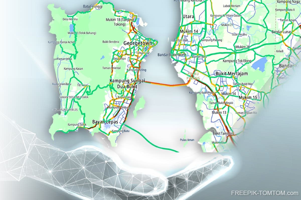
According to the 2024 TomTom Traffic Index that was released in January, drivers lose an average of 75 hours a year to rush-hour congestion, equivalent to three days and three hours spent idle. The average time to travel just 10km during the morning rush exceeds 26 minutes, placing it at No 73 out of 500 cities globally.
This chronic congestion is more than just a daily nuisance, it has become a growing economic and environmental concern, says Bashir. Outdated infrastructure and limited uptake of public transport have contributed to the problem.
In response, MBPP has made easing congestion a core objective of its smart city goals. “Now with the integration of Waze [a live map], we know what is happening on the ground. With historical data, we know where the accident-prone areas are. Straight away our [team] will be there to take care of the situation,” he says.
The use of Waze, a satellite navigation software, and CCTV footage has enabled the council to respond quicker to incidents and coordinate better with the public. “Before this, you had to wait [for] people to complain. But now, that’s gradually becoming irrelevant,” says Bashir.
MBPP has installed 1,137 CCTV cameras on the island to date. These are used in tandem with road analytics and crowd flow data to address issues such as traffic congestion.
“We even know where the accident-prone areas are. So we know that in this area, something is wrong. So we must take action in that area,” he says.
Beyond real-time analytics, the council is working closely with Rapid Penang to increase public awareness and uptake of public transport. Additional measures being implemented include limiting parking hours in commercial zones, restricting heavy vehicles during peak periods and installing smart traffic lights along the Tanjong Tokong-Tanjung Bungah and Bayan Baru corridors to optimise traffic flow.
Data is also helping with tax enforcement and licensing. A Geographic Information System (GIS) -linked tax dashboard tracks payment status lot by lot, while another module monitors compound notices. Licensing dashboards give the council real-time insights into the types and volumes of permits issued.
“We use our GIS data with our payment records so we know who has paid and who hasn’t paid tax, lot by lot, premise by premise,” says Bashir.
GIS supports the city administration by providing spatial insights and accurate mapping of properties and land parcels, thereby enabling more efficient tax collection.
But all these systems are still transitioning from analytic platforms to a fully AI-integrated one. “The systems aren’t fully AI-enabled … but we are moving towards AI,” he says.
A future where AI independently draws data from across modules, makes decisions and automatically alerts the relevant authorities is definitely on the horizon, he stresses.
“For example, when the weather sensor detects strong wind, it should immediately alert us, notify traffic authorities to exercise caution and inform the landscape team to inspect the site. If a tree is at risk of falling — say, it has tilted beyond a certain threshold — the sensor should identify it as high-risk. The AI should then be able to determine, with 90% certainty, that the tree is likely to fall and immediately recommend closing the affected road.
“This is the kind of AI system we need. I don’t want a setup where the system only tells me there’s a gale blowing, and I have to manually assess or figure out which roads are at risk, or which trees might fall. I want the AI to carry out the full analysis and send the information straight to our Integrated Operations Centre (IOC). We can then dispatch our team to close the road and inform the public via Waze or other navigation channels. That’s the role of AI — pulling data from various modules, analysing it and acting on it swiftly and accurately.”
As MBPP eyes full AI integration, Bashir assures that the city’s authorities are mindful that data quality and security are non-negotiable.
“If the data is not ready, then we cannot proceed. It’s very important that … the data has to be verified and ready to be used. It must be in the correct format so other platforms can retrieve the data,” he says.
On cybersecurity, he adds: “We do have our security measures. Our IT departments, we have our firewalls and everything ready. We keep our data in the PDSA (Public Sector Data Centre), which is under the Malaysian Administrative Modernisation and Management Planning Unit (Mampu). We have put in a lot of money to make sure our safeguards are in place. Overall, we have spent RM10 million on [this digital twin] initiative.”
The council is currently preparing for the official launch of all 10 smart city modules. “The launch is targeted for May or June this year. All 10 [modules] are ready for the launch actually,” says Bashir.
Building a collaborative digital intelligence
In the longer term, MBPP hopes its evolving digital ecosystem can serve as a replicable model for other city councils across Malaysia. Bashir says the strength of the initiative lies in its modularity and scalability.
“Each city has its own challenges, but this approach allows flexibility. You can plug in or build on what’s relevant to your [city’s] context,” he points out.
Engagement with the community will be a key part of the smart city’s next phase. MBPP is planning public awareness campaigns and workshops to familiarise residents and developers with the tools available.
“Actually, when people understand the technology, they can use it to their advantage. For instance, an architect can simulate a proposed building in the Unesco zone before they even buy the land,” he says.
At the heart of the transformation is a closer collaboration between departments, an operational shift which Bashir says has been instrumental to smart governance. “We cannot work in silos anymore. Planning, engineering, IT, enforcement — we all need to work together with the same data.”
That same principle applies to federal and state collaborations. He says continued support from agencies like PLANMalaysia, the Department of Survey and Mapping Malaysia (JUPEM) and international counterparts like Hong Kong’s geotechnical division will be instrumental in furthering its technical prowess.
Bashir asserts that MBPP is committed to open data, within legal and ethical boundaries. “We will anonymise what needs to be anonymised. But the public should have access to traffic trends, environmental indicators and planning tools. It’s their city too.”
One of the more future-forward developments is MBPP’s intention to build digital intelligence that functions as the city’s central operating brain. This will likely include machine learning capabilities, scenario simulations and automated alerts to the relevant authorities.
“We will need a few hundred data points to do the monitoring and improve prediction. This is where AI comes in,” he says.
More importantly, Bashir believes that the move to AI is not just about technology, but a mindset shift in governance. “You have to be ready to move to AI. That’s the most important. It is not just having the system, it’s about cleaning, verifying and preparing your data for AI to work.”
This data-centric outlook is already reshaping how MBPP views capacity-building. Instead of relying solely on external vendors, the council has been developing internal capabilities to manage and adapt the systems.
“So far, the brain part of it, we are doing it. It has to be us ... we cannot let other people do it because we know what our demands, our needs, are,” he says.
The council intends to call for tenders at a later stage to support broader system enhancements, but the core logic and architecture will remain an internal undertaking.
“There is no shortcut. To come up with this real-time tool, we have to sit down and read one by one ... there is never-ending R&D that we have to do. It’s not about showing off. It’s about how we solve problems faster, how we plan better and how we protect what matters,” says Bashir.
Save by subscribing to us for your print and/or digital copy.
P/S: The Edge is also available on Apple's App Store and Android's Google Play.